Nant Power Station

OS Grid Ref: NN 19210 13310(access tunnel portal)
Date opened: 1963
Date closed : Operational
Nant, commisioned towards the end of 1963, was one of the last conventional
hydro stations to be built by the Hydro Board.
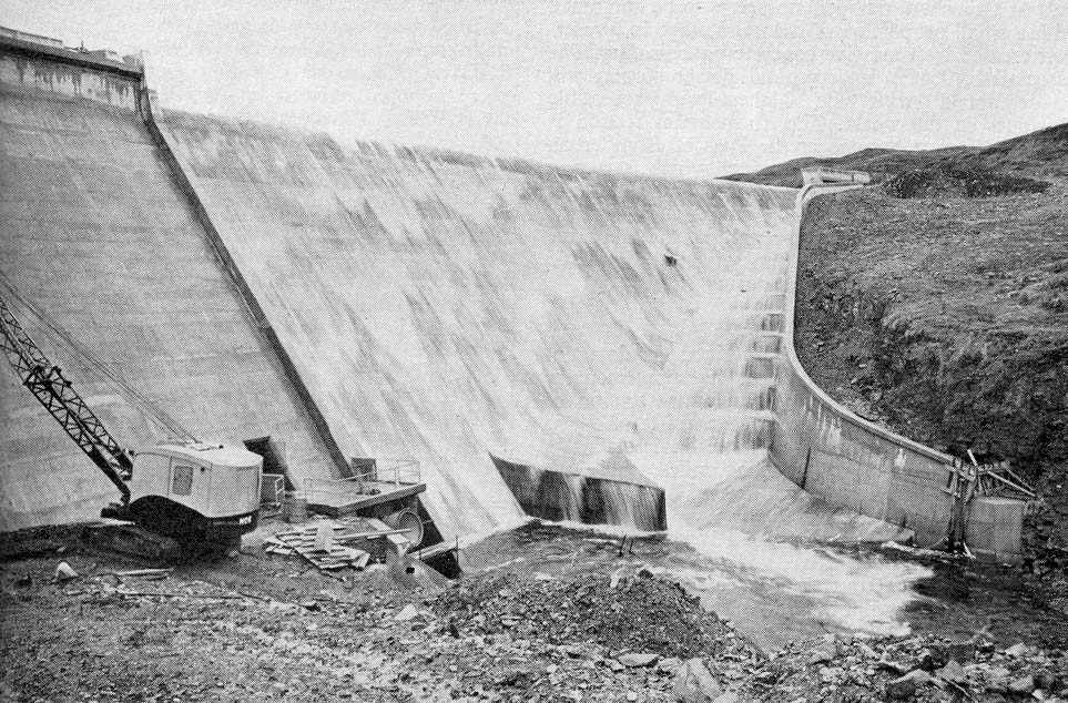
Nant is a small station, capacity 15MW. The Nant dam, 1220ft long and 93ft
high, considerably enlarged loch Nant. From an intake tower on the South
shore of Loch Nant, water is led by tunnel to the underground Nant power
station, operating under a head of 535ft. The Fionain aqueduct and tunnel
system, 5 miles long, captures water from the slopes above Loch Awe and
leads it into the surge shaft, providing additional water for the turbine.
There are 35 images of Nant in the Records, and 6 webpages. They may all be accessed via the map at the bottom of this page, which is a clickable image map. Each area selected will open in a new window.
The dam and water intake lie a long way up a private road behind a locked
gate which I have yet to successfully pentrate! Thus, the only image of
this part of the scheme is from archival material.
Drilldown to high-resolution imagery IS available online for this site
- click on any image, a high-resolution version will open in a new window
A short video sequence touring the machine hall exists but is not yet online.
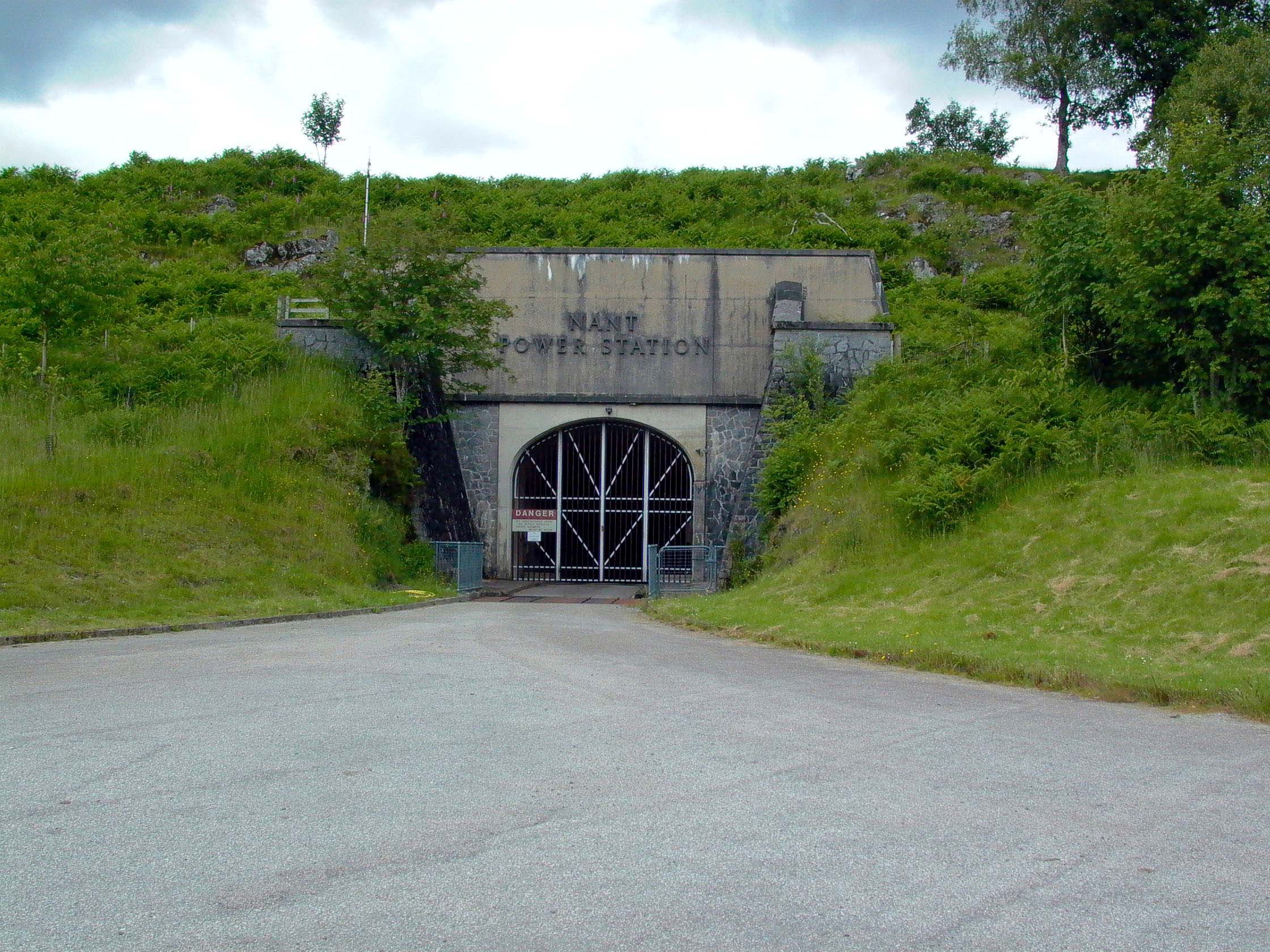
Photo: Nant access tunnel portal
Photo by: Mike Ross
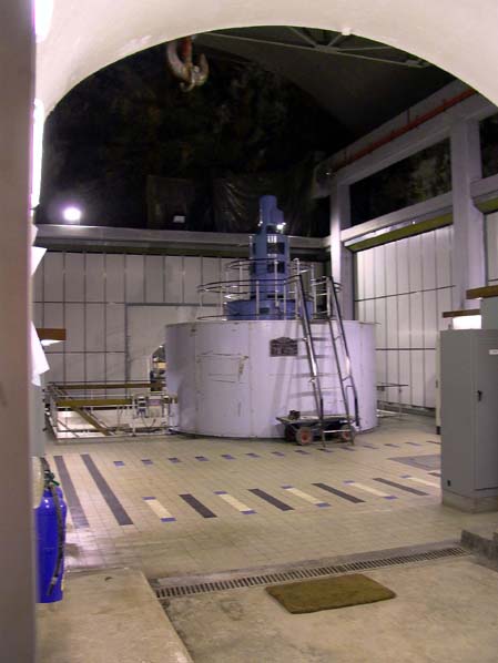
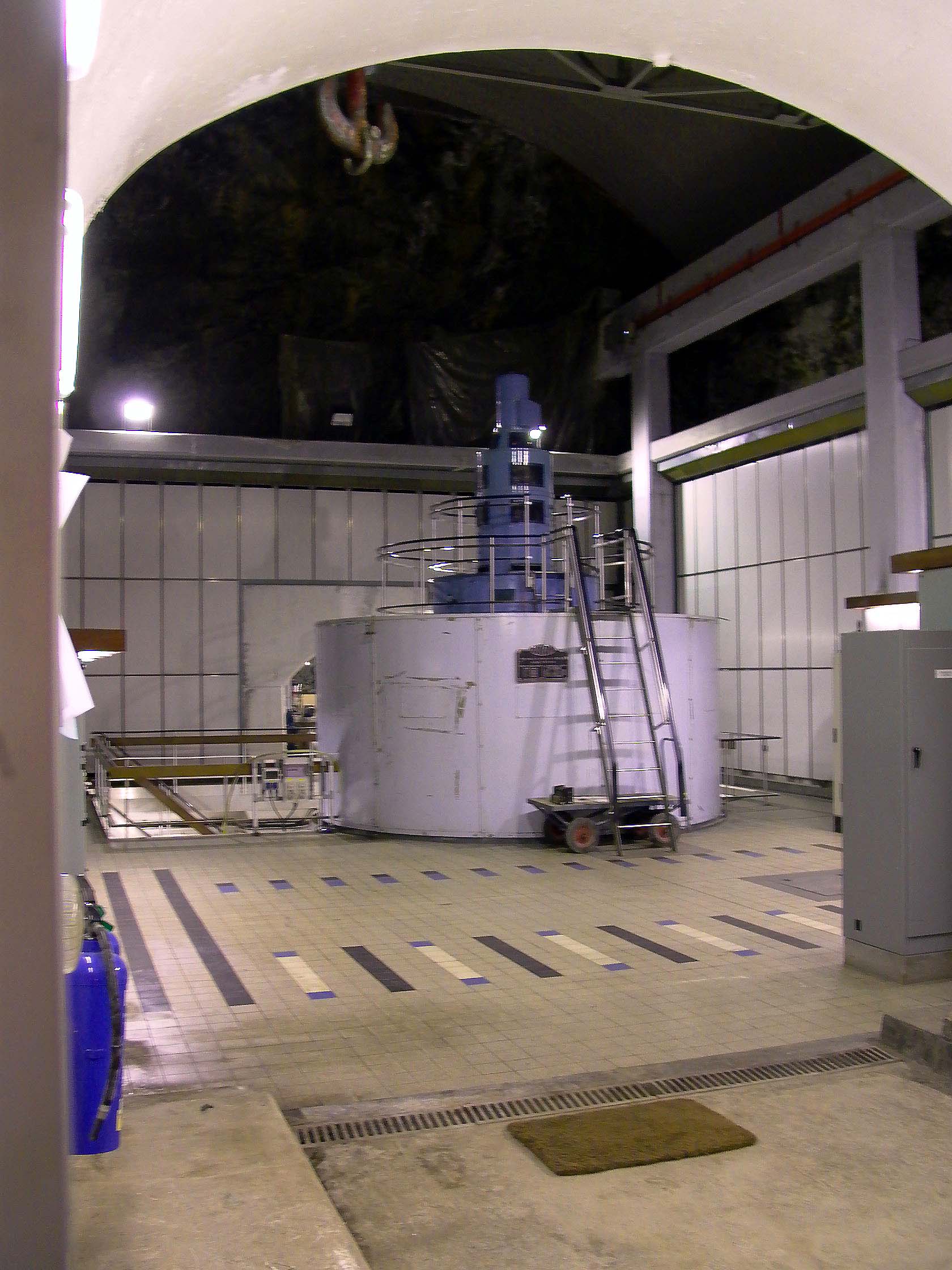
Photo: Nant power station - interior
Photo by: Mike Ross

Photo: Nant Dam
Photo by: Scanned by Mike Ross, from 'Water Power', May 1964
The map below is an imagemap - click on the area you wish to explore
(Clickable areas are the red text)
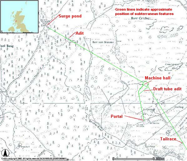 . .
Illustration: Map of Nant power station area
Illustration by: Canmap, additional legend Mike Ross
Home Page
Last updated 5th March 2003
Style © 1998-2001 Subterranea Britannica
Words and images © 2003 Michael J. Ross

|