The above is an image map, use it to navigate the site. Best viewed at 1280 x 1024 using any browser.
Invergarry Power Station
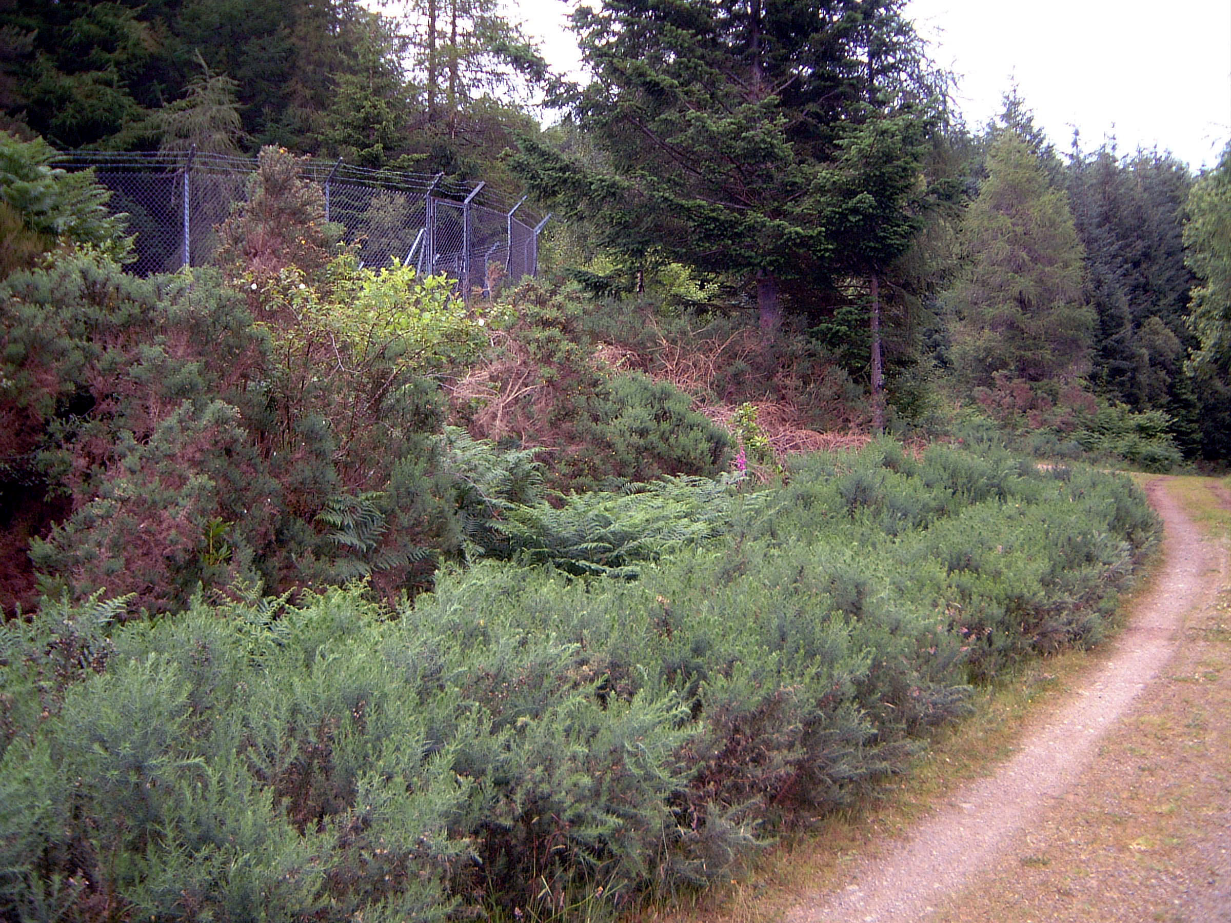
OS Grid Ref: NH 31916 013025 The surge shaft at Invergarry is hidden away in the trees on the slope
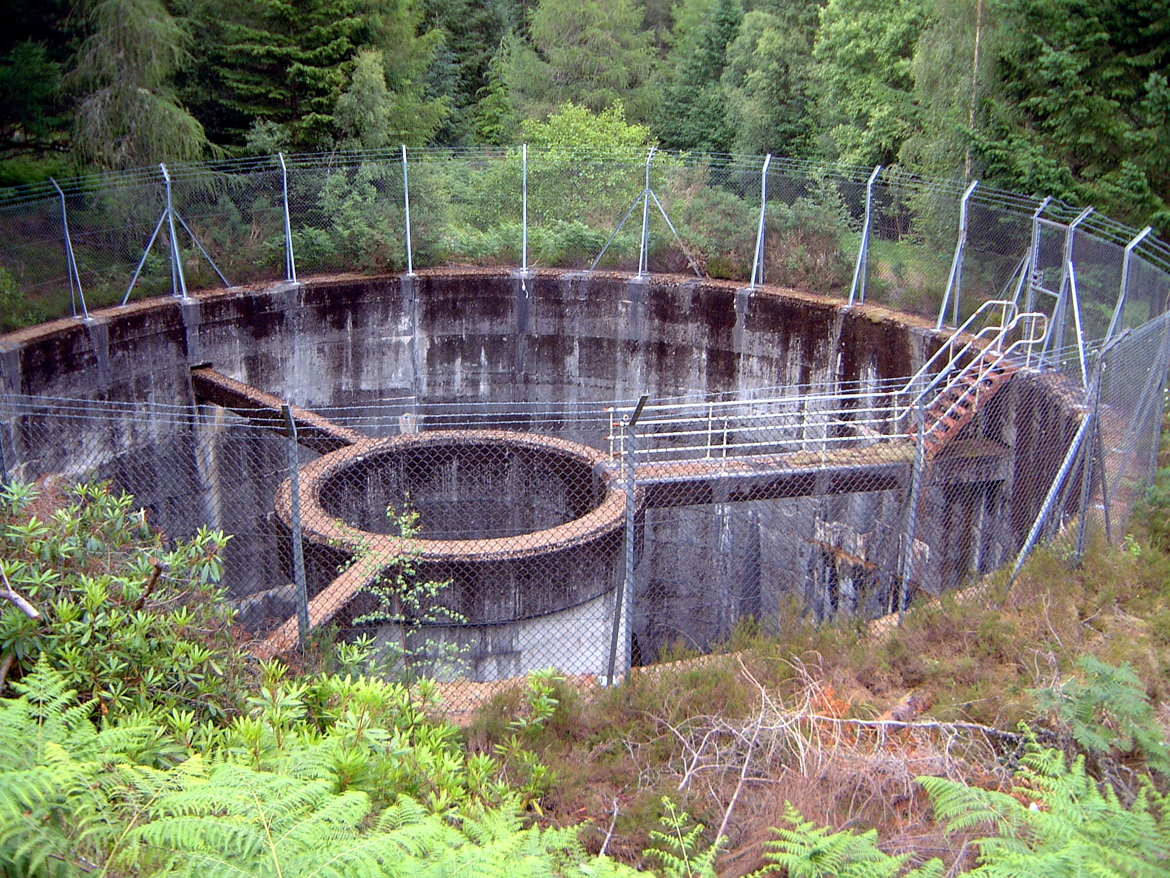
immediately above the power station. It's accessible by a forestry road: Photo by: Mike Ross The design is unique in Scotland: a differential shaft with a central riser: Photo by: Mike Ross This drawing makes the arrangement clear. The differential riser extends
the vertical HP shaft upwards. In a surge condition, water can rise up
the riser and overflow into the surge chamber. The restrictor orifices
at the base of the riser damp the surge between the chamber and the HP
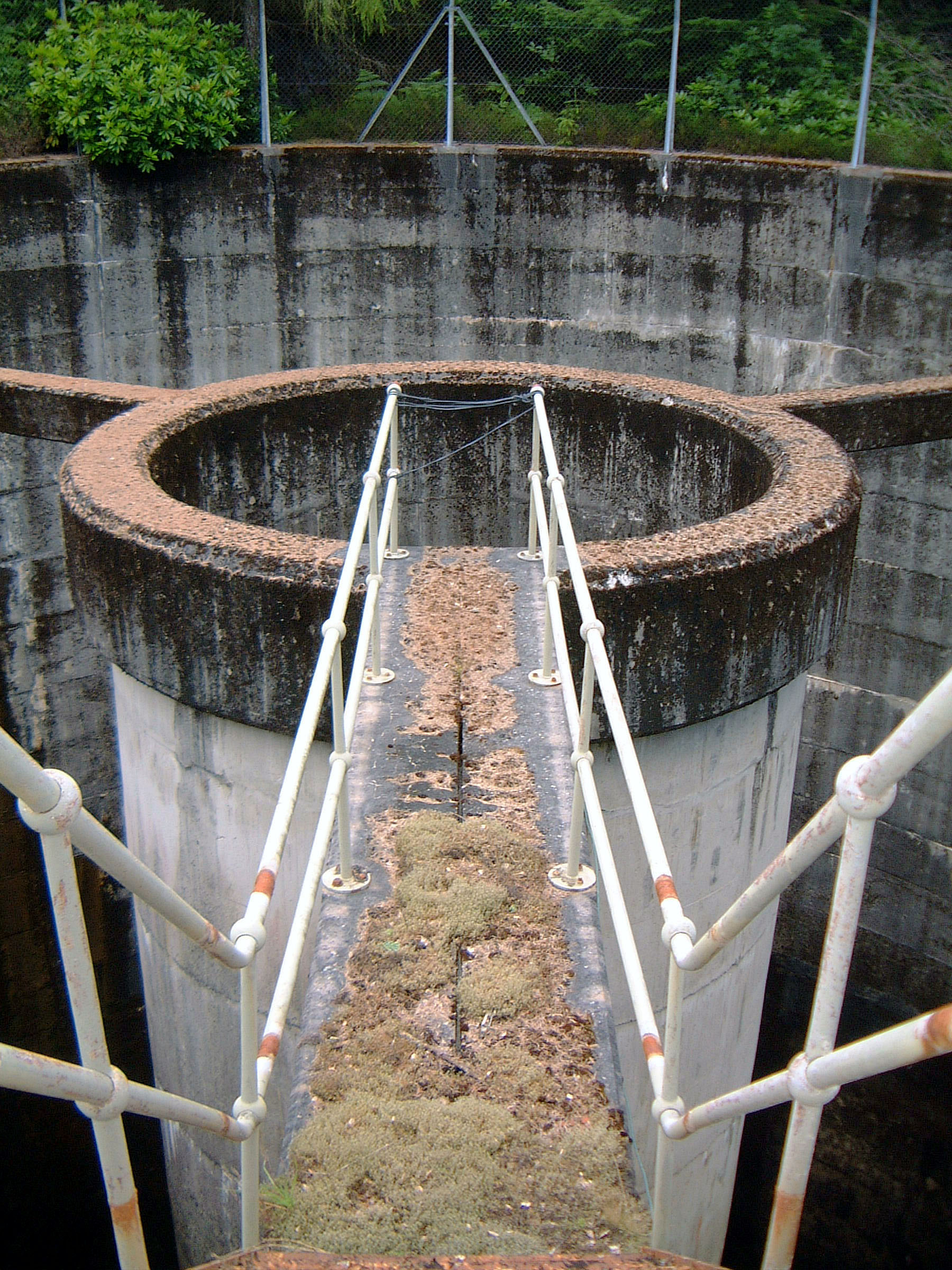
shaft. Drawing by: Scanned by Mike Ross, from Proceedings of Institute of Civil Engineers The access bridge to the riser. Not used for anything very much, obviously.
And I don't like the look of that rope 'handrail' at the end of it; it's
sheer drop of 230ft down the riser and HP shaft! Photo by: Mike Ross On the day I visited the refurbishment was in full swing, and the shaft
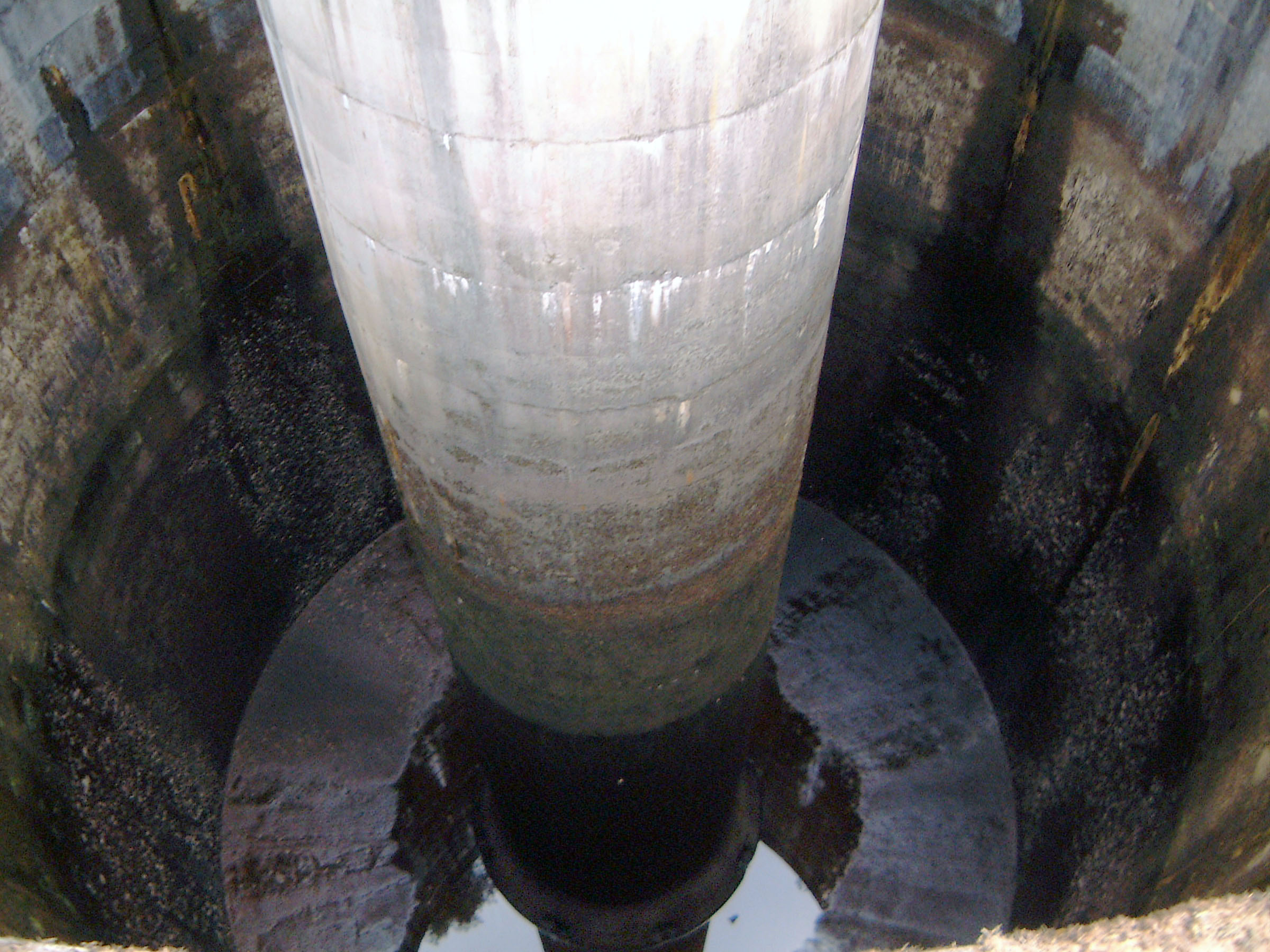
was dewatered for maintenance. On the full-size image you can just make
out the orifices at the bottom of the riser shaft. The shaft is 60' in
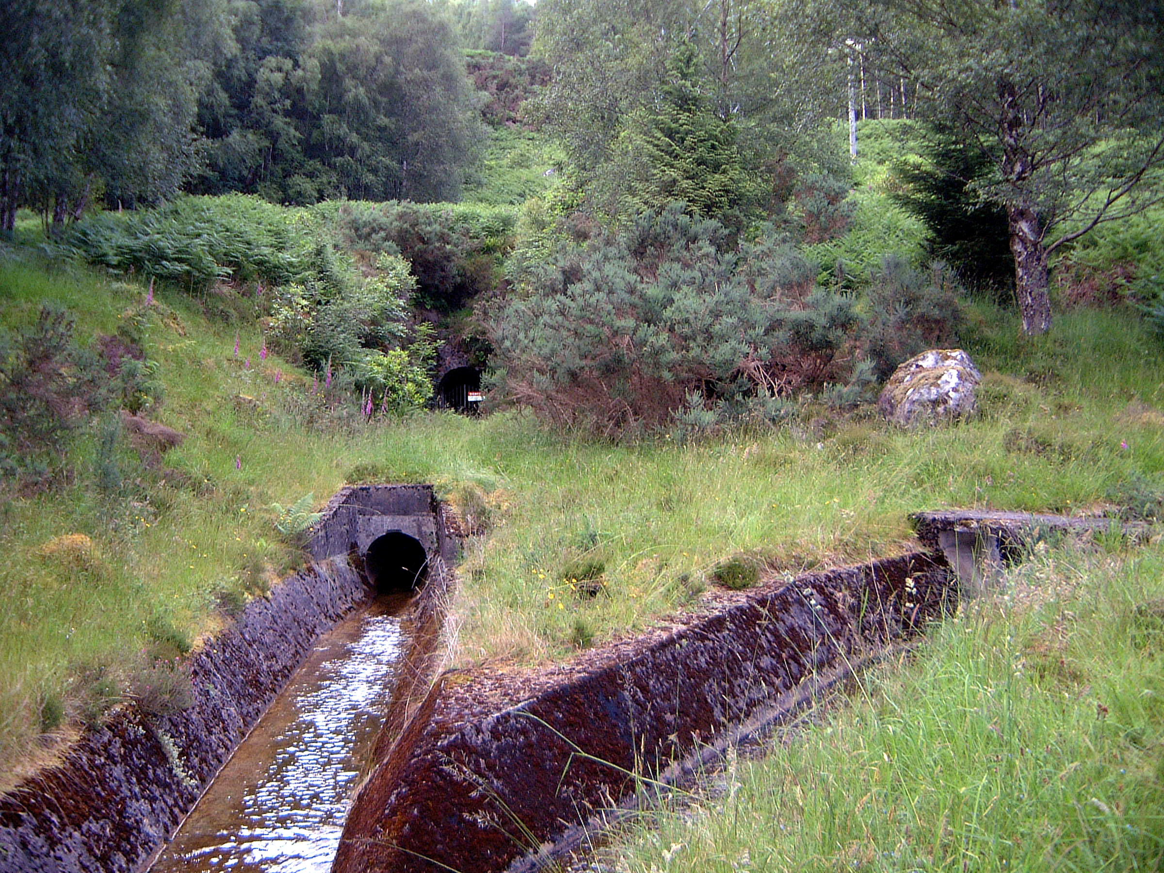
diameter and around 100' deep: Photo by: Mike Ross Just downslope from the surge shaft is the construction adit, on the left
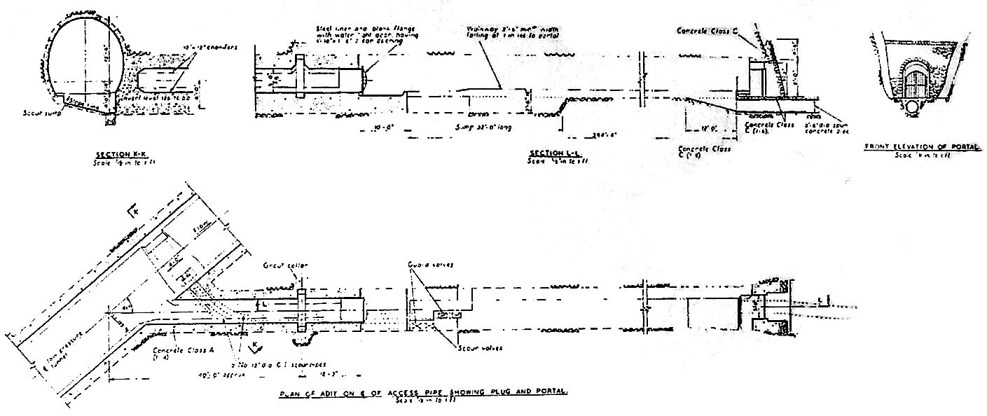
below, with a drain outlet for seepage water below it: Photo by: Mike Ross This original construction drawing shows how the adit is built, and how
it intersects with the LP tunnel just upstream from the surge shaft: Drawing by: photograph by Mike Ross of original construction drawing. Home Page Last updated 6th February 2006 Style © 1998-2001 Subterranea Britannica Words and images © 2006 Michael J. Ross
|