The above is an image map, use it to navigate the site. Best viewed at 1280 x 1024 using any browser.
Invergarry Power Station
OS Grid Ref: NH 31916 013025 Invergarry dam is a fairly modest structure, 50ft high and 150ft long.
It was constructed in a gorge downstream of the original outlet of Loch
Garry. The small size of the dam was a result of the requirement to minimise
disruption of agriculture in the area; only a relatively small increase
in the level of Loch Garry could be permitted, as valley grazing was already
at a premium in this area. Invergarry dam, hidden away in a pretty gorge (the small culvert in the
bank of the river is a fish bypass tunnel, designed to make the gorge easier
for migrating salmon heading upstream): Photo by: Mike Ross This archive shot, taken just after completion of the dam, gives a better
idea of the layout of the structure. A trash chute for passing floating
debris on the left, then two discharge gates, and on the right the compensation
water power station, and the entrance to the Borland fish lock: Photo by: Scanned by Mike Ross, from Proceedings of Institute of Civil Engineers 1958 Another archive shot. The dam on the right, in the middle the elaborate
screens around the intake to the power tunnel, and on the extreme left
the spillway channel leading to the spillway tunnel. A car can be seen
on the track leading to the dam; the gatehouse for the power tunnel is
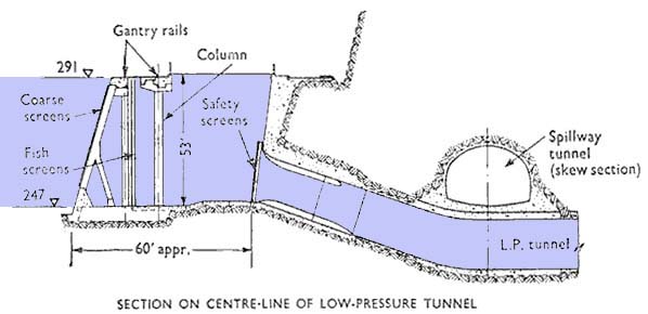
out of sight, behind the knoll of rock to the right of the car: Photo by: Scanned by Mike Ross, from Proceedings of Institute of Civil Engineers 1958 This drawing makes the arrangements of tunnels, intake, and dam clearer: Photo by: Scanned by Mike Ross, from Proceedings of Institute of Civil Engineers 1958 And this drawing shows how the power tunnel intake burrows under the spillway
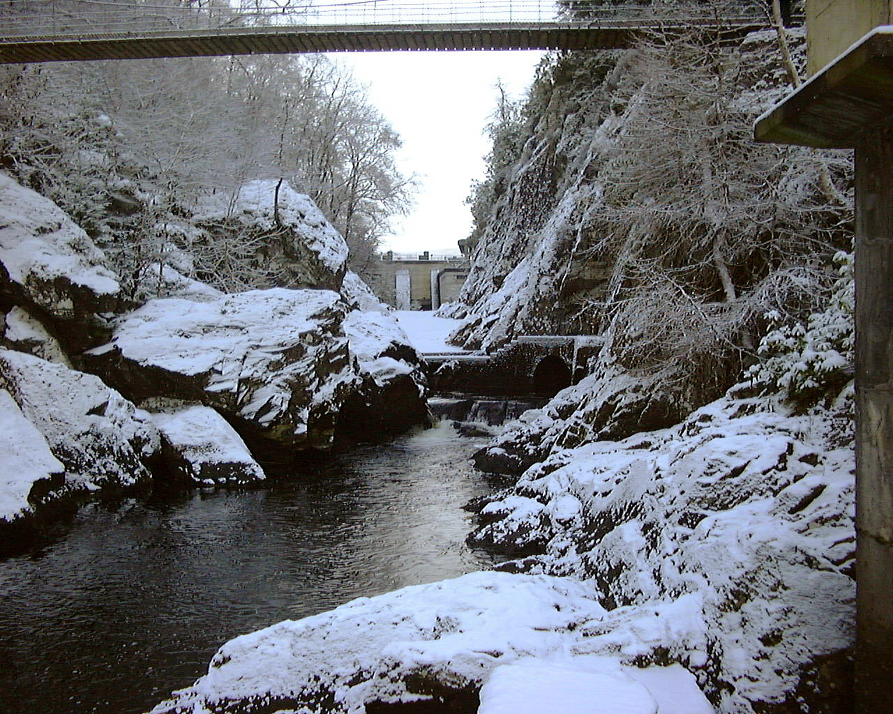
tunnel: Photo by: Scanned by Mike Ross, from Proceedings of Institute of Civil Engineers 1958 Invergarry Dam - looking into the entrance of the spillway tunnel on the
left bank: Photo by: Mike Ross Inside the spillway tunnel, looking back at the spillway. The small culvert
visible in the base of the spillway is the emergency compensation water
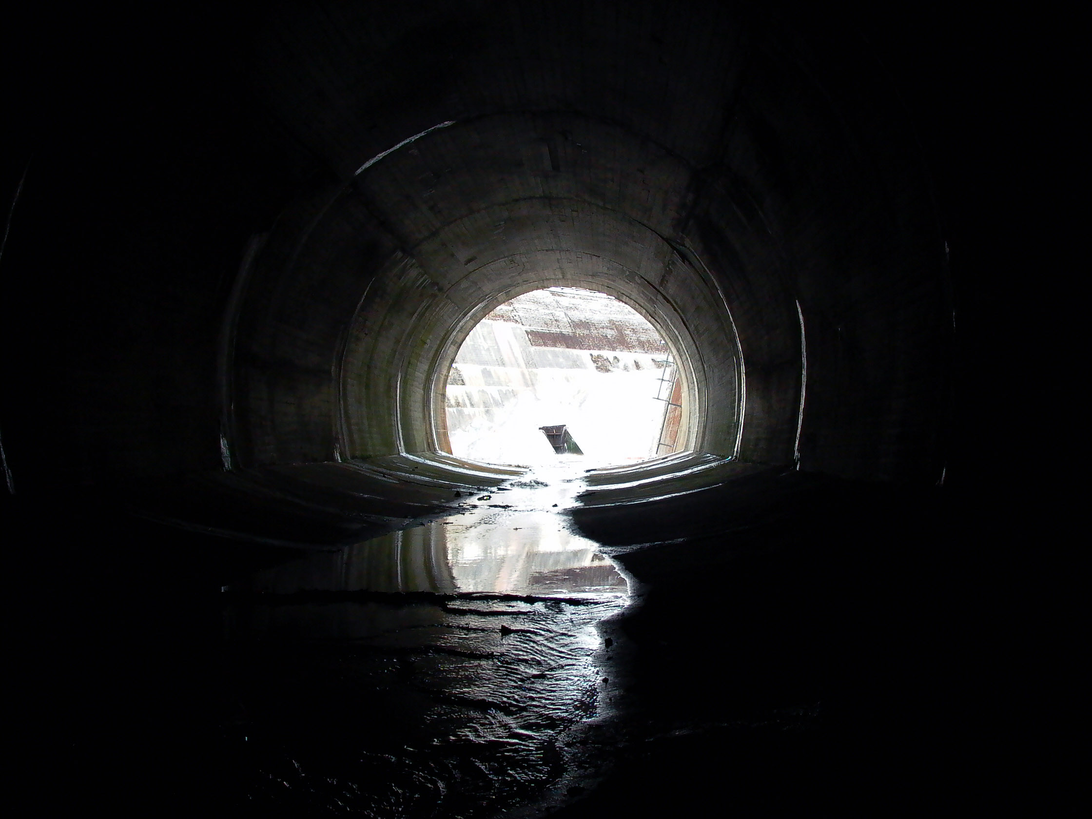
culvert mentioned on the drawing above: Photo by: Mike Ross In the spillway tunnel, looking downstream. Your intrepid explorer gives
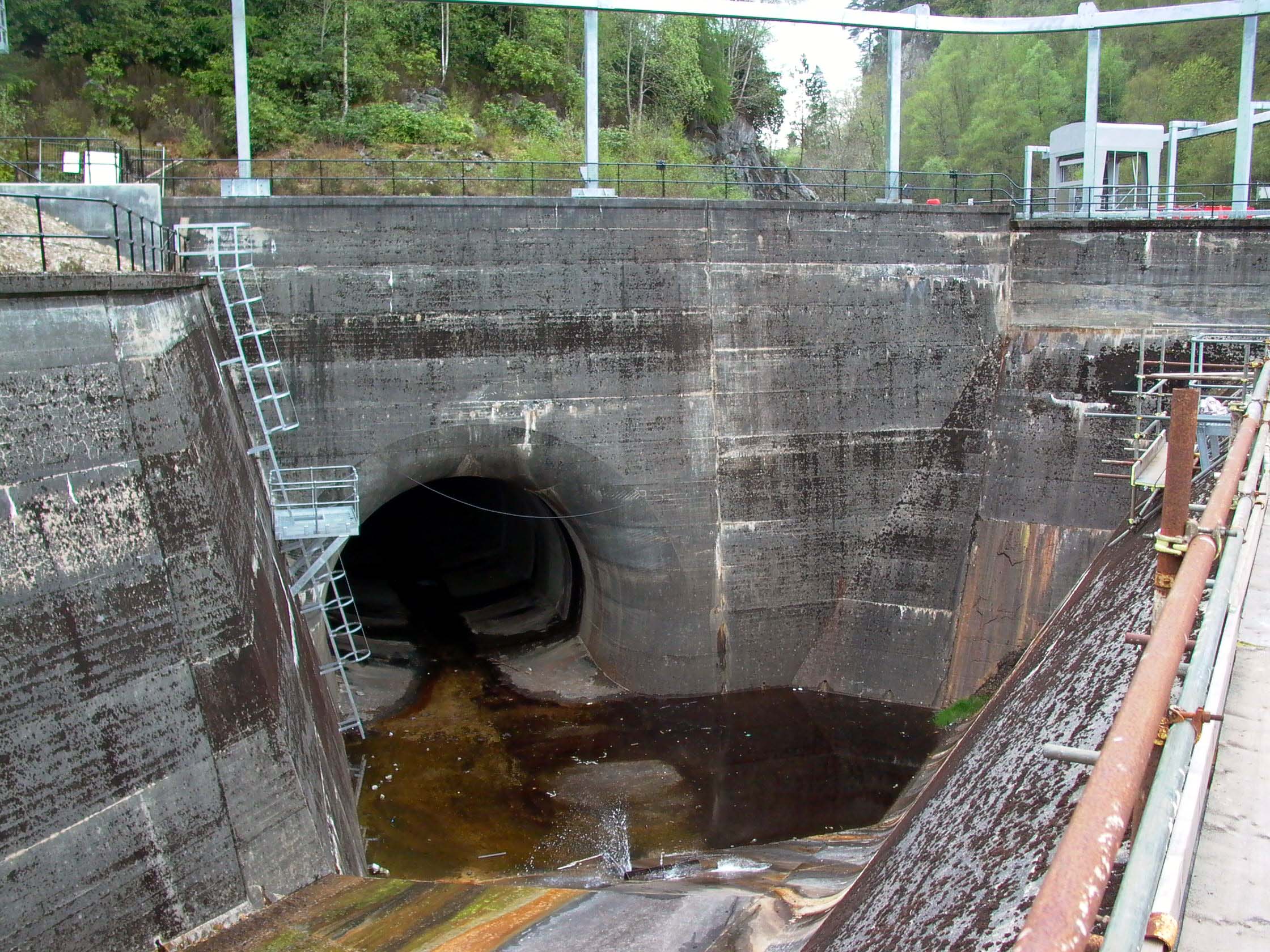
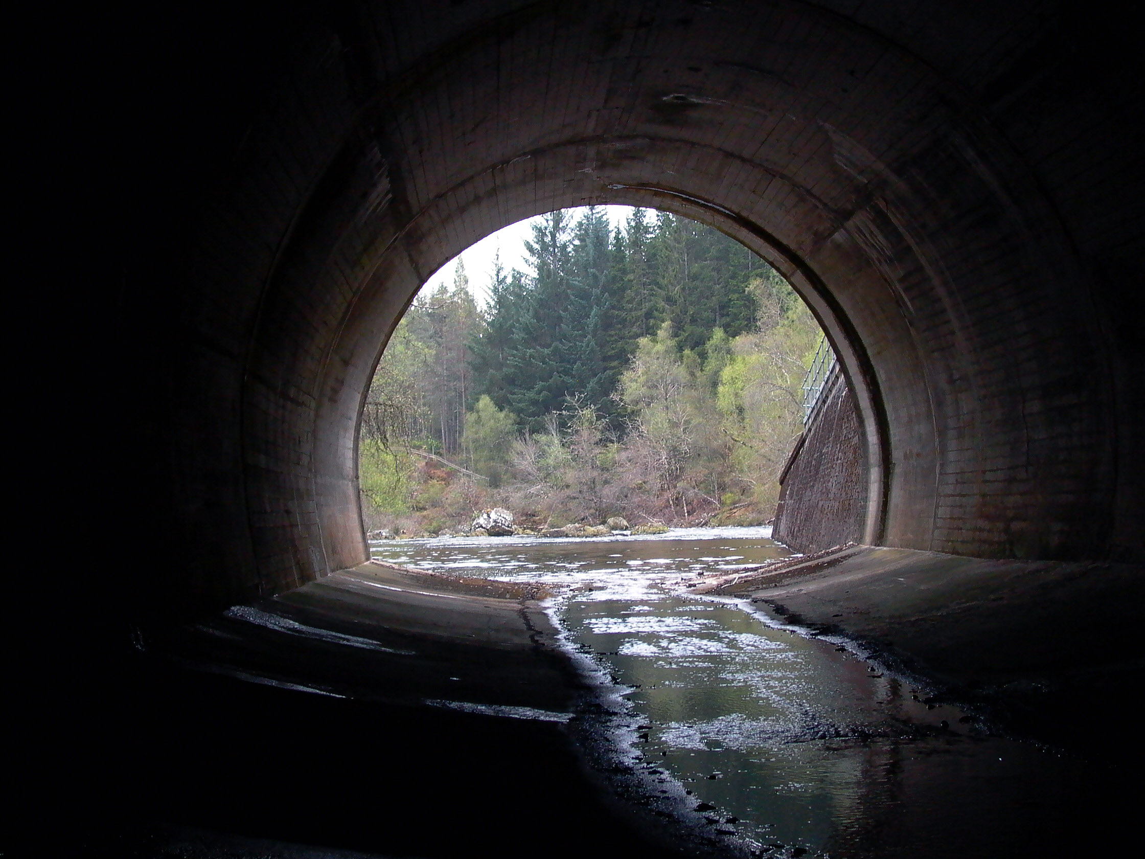
scale - it's a fair sized tunnel, 24ft equivalent diameter: Photo by: Mike Ross Spillway tunnel exit from the outside in low water: Photo by: Mike Ross The spillway tunnel discharges on the left bank of the river a few hundred
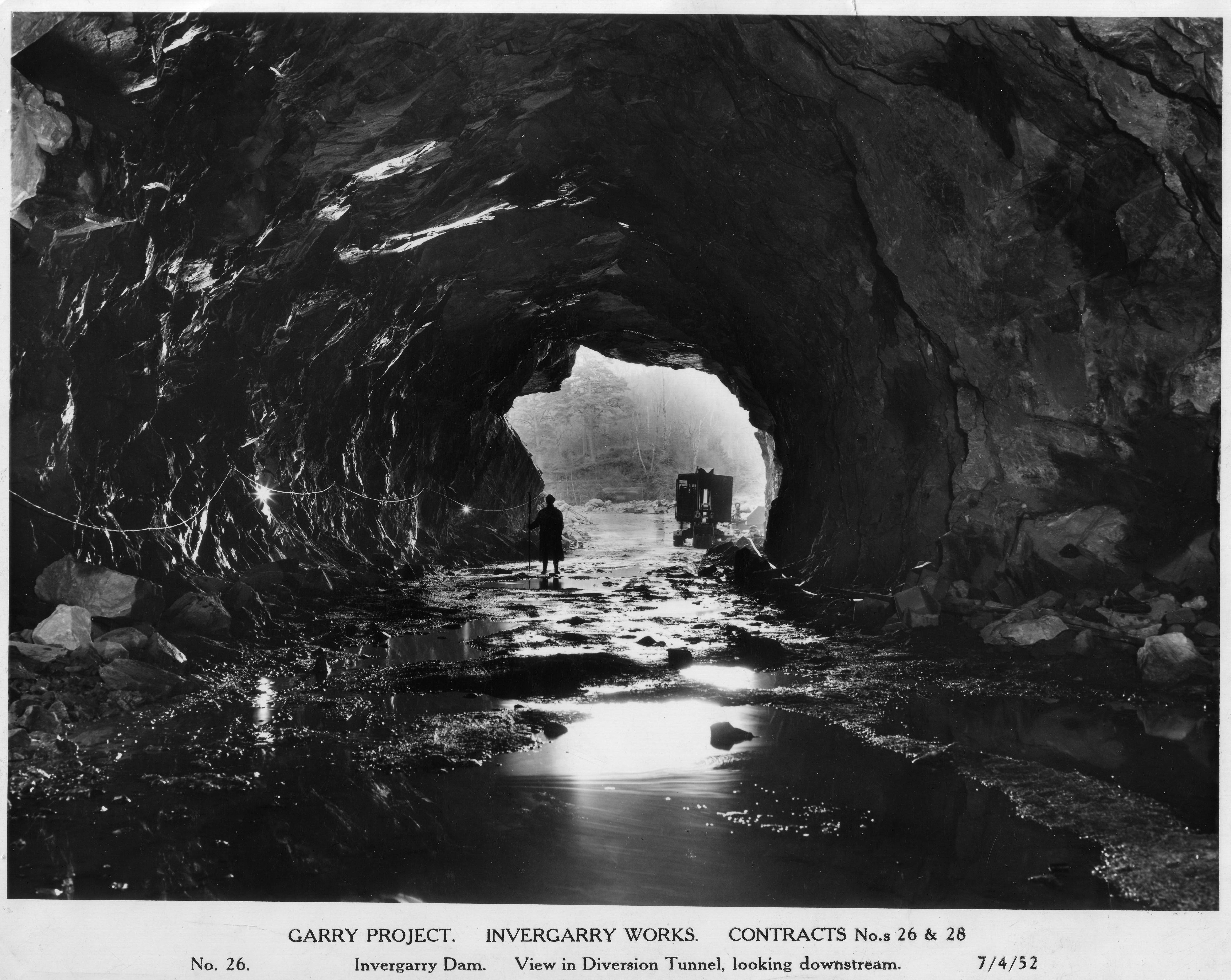
feet downstream of the dam. The exit, from the inside, in high water: Photo by: Mike Ross An archive shot of the tunnel under construction, take from almost the
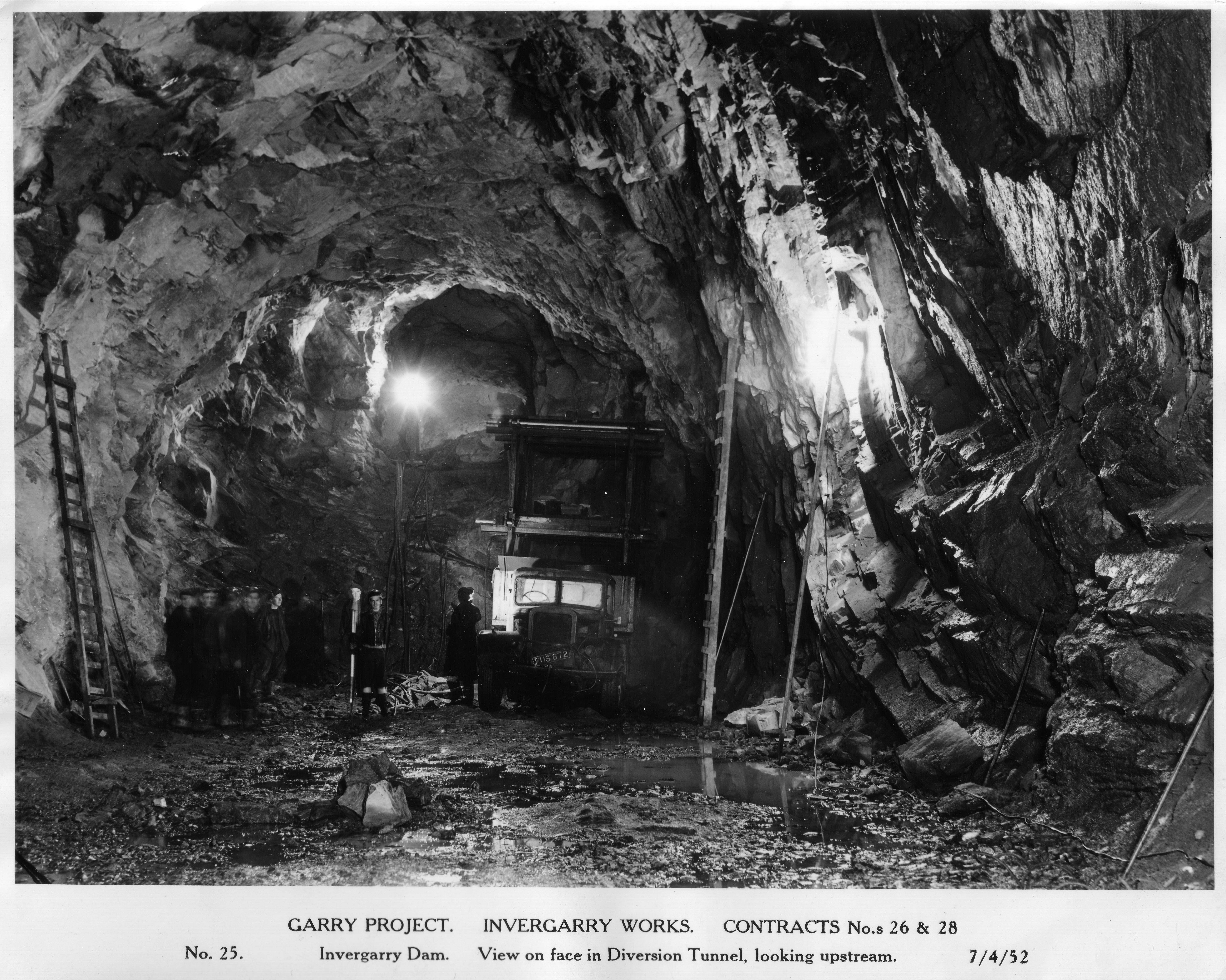
same position as the above shot: Photo by: Scanned by Mike Ross, from NOSHEB archives Another archive shot of the spillway tunnel under construction; it was
used to divert the flow of the river whilst the dam was being constructed: Photo by: Scanned by Mike Ross, from NOSHEB archives Home Page Last updated 6th February 2006 Style © 1998-2001 Subterranea Britannica Words and images © 2006 Michael J. Ross
|