The above is an image map, use it to navigate the site. Best viewed at 1280 x 1024 using any browser.
Ceannacroc Power Station
OS Grid Ref: NH 22393 10846 (access tunnel portal)
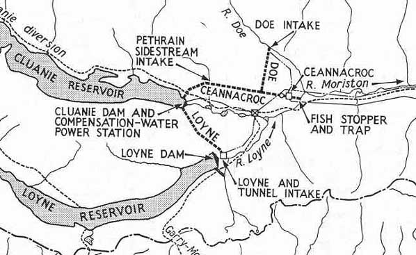
The Garry-Moriston scheme was constructed during the 'peak' years of the
Hydro Boards construction schemes, the early-mid '50s (started 1949, the
final station (Livishe) not being commissioned until 1963). The design
of the scheme was relatively advanced by the Hydro Board standards of the
time - whilst many schemes were still using surface power stations and
steel surface penstocks for the high pressure system, Garry-Moriston was
built with only one surface power station (Quoich) - three were completely
underground, and one partially so. All the high-pressure systems were built
underground, with high-pressure shafts and penstock tunnels. Illustration: Ceannacroc Map There are 105 images of Ceannacroc in the Records, and 8 webpages. They may all be accessed via the map at the bottom of this page, which is a clickable image map. Each area selected will open in a new window. Drilldown to high-resolution imagery available throughout - clicking on any image will bring up the full-resolution original in a new window. Be warned, most of these are large (2400 x 1800, as much as 700-800kb). A short video sequence touring the machine hall exists, as does another covering the adit, LP tunnel, and surge shaft, but they are not yet online. 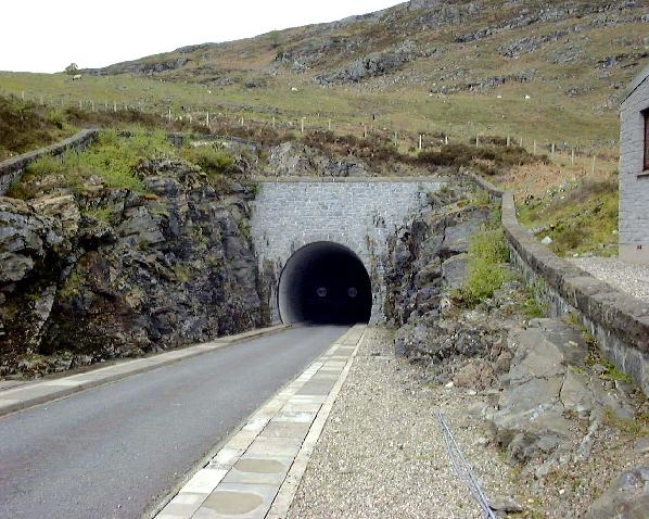
Photo:
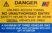
Ceannacroc access tunnel portal The map below is an imagemap, and allows you to navigate the Ceannacroc pages. You can click on any of the red text on the map, or the legend on the lower right, and the web page for the corresponding feature will open in a new window 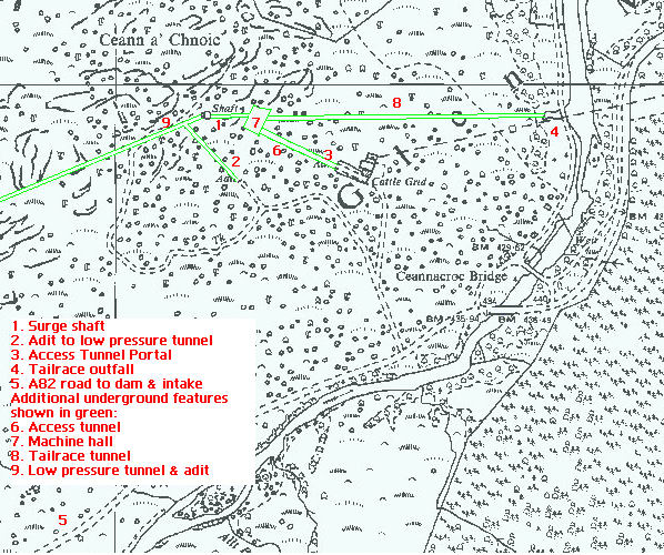
Illustration: Ceannacroc Area Map Home Page Last updated 6th May 2006 Style © 1998-2001 Subterranea Britannica Words and images © 2006 Michael
J. Ross. |